Simple, Premium Pricing
One report, one clear price. Enterprise-grade environmental intelligence without hidden fees.
ONE-TIME REPORT
Government Records Report
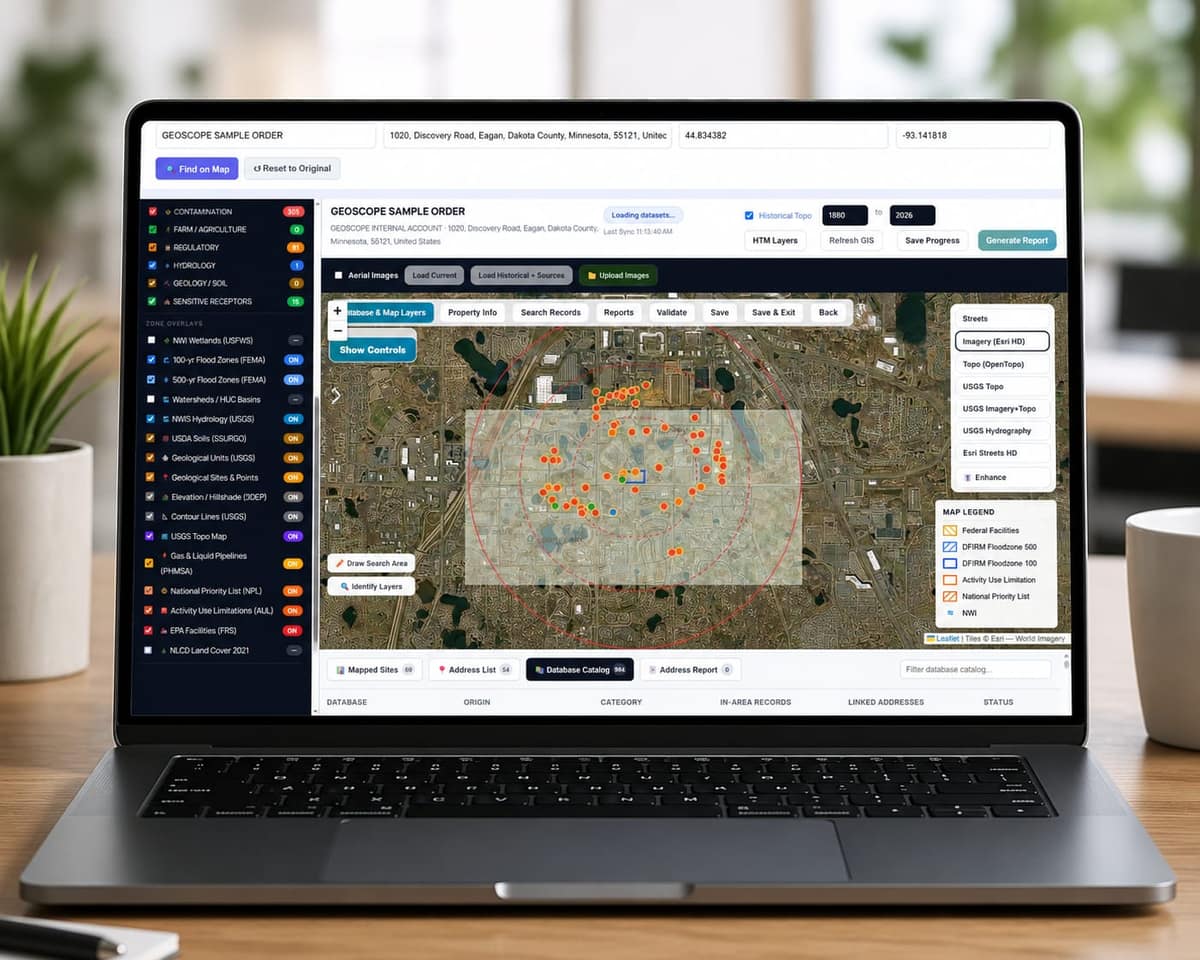
Environmental records organized by database, with maps, aerial photographs and historical references.
- Database screening across 1,500+ federal, state & local sources
- GIS map showing all regulated sites near the subject property
- Flood zone & wetland overlay
- Historical topographic context
- Soil, geology and radon context for the area
- Aerial photographs of the property from more than one year
- Source-cited records table with distance rankings
- Professional PDF, ready for lenders, attorneys & due diligence
- Delivered within 24 hours of order confirmation
Questions before you order
Straight answers about what a report is, what it costs and what it does not do.
Read all questions →What is in a Geoscope report?
A findings summary, the subject property details, records organized by database with distance and direction, numbered maps, aerial photography, soil and geology context, historical topographic maps and a list of the databases that returned nothing.
How long does it take and what does it cost?
Most reports are delivered within 24 hours of order confirmation. A Government Records Report is $79, with no subscription.
Is this a Phase I Environmental Site Assessment?
No. A report is records and mapping research. It has no site visit, interviews or professional opinion, and it does not replace a Phase I. Many teams use it as the starting point.
Where does the data come from?
Government environmental databases plus third-party sources. Every record shows its source agency, dataset version and retrieval date.
Does Geoscope cover my state?
Geoscope covers all 50 states. Federal databases apply everywhere, and state and local databases are included where the source makes the data available.
Is the report analyst-reviewed?
Yes. A Geoscope analyst places each record at its correct location, confirms the property location, and checks that the record details are accurate before the report is delivered.
Can I order for multiple properties?
Yes. Each property is $79 per report. Contact us for bulk or portfolio pricing.
Ready to get started?
Order a professional environmental report in minutes. Delivered within 24 hours.